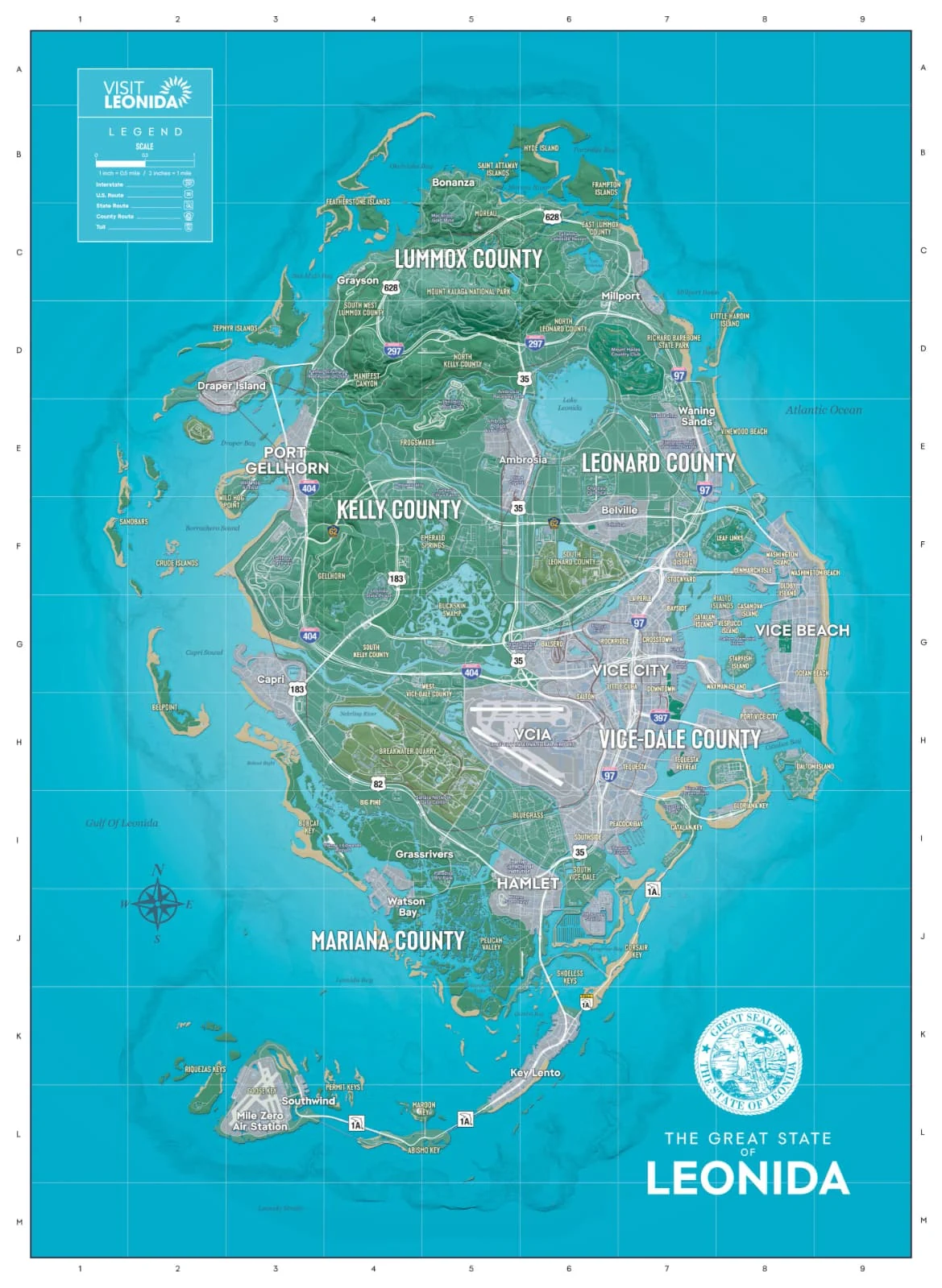
Rockstar Games has published the official map of Leonida, the state where GTA VI is set, with a grid of letters (A to M, north to south) and numbers (1 to 9, west to east). Here are the 91 named places that appear on it, county by county, with the square each one sits in.
How to read the grid: E3 is row E and column 3. Squares are approximate and taken from where each name is printed on the map. Places with their own page are linked; there you will find what is inside: banks, shops, mod shops, races and activities.
The same places are pinned on the interactive map (in Spanish).
Vice-Dale County: Vice City, the airport and Hamlet
35 places.
Mariana County: the southern keys and swamps
17 places.
| Place | Grid square |
|---|---|
| Capri | G3 |
| Belpoint | H2 |
| Bobcat Key | I3 |
| Grassrivers | I5 |
| Mariana County | J4 |
| Watson Bay | J4 |
| Pelican Valley | J5 |
| Shoeless Keys | J6 |
| Corsair Key | J7 |
| Riquezas Keys | K2 |
| Goose Key | K3 |
| Key Lento | K6 |
| Mile Zero Air Station | L3 |
| Southwind | L3 |
| Permit Keys | L4 |
| Abismo Key | L5 |
| Maroon Key | L5 |
Kelly County: Port Gellhorn and the west coast
14 places.
Leonard County: Lake Leonida and Waning Sands
10 places.
Lummox County: Mount Kalaga and the north
15 places.
What the map says about the leaks
The official map confirms names that leaked before launch: Lummox County, Pelican Valley, Southwind, Key Lento, Moreau and also Goose Key, next to Mile Zero Air Station in the far south-west. There is no sign of Manzana. The full check is in which leaks were right.
Squares read from the official Leonida map published by Rockstar Games on 19 November 2026.